
Auf dem Schäfersteig
Mittel
10.2 km
4:15 h
450 Hm
611 Hm
")
Filip Zuan
4 Bilder anzeigen
Filip Zuan
Beste Jahreszeit
Jan
Feb
Mär
Apr
Mai
Jun
Jul
Aug
Sep
Okt
Nov
Dez
Start
Signpost at the Votlas car park on the road that branches off next to the Hotel Post in Samnaun
Ziel
Bus Stop in Compatsch
Koordinaten
46.942569, 10.361994
Details
Beschreibung
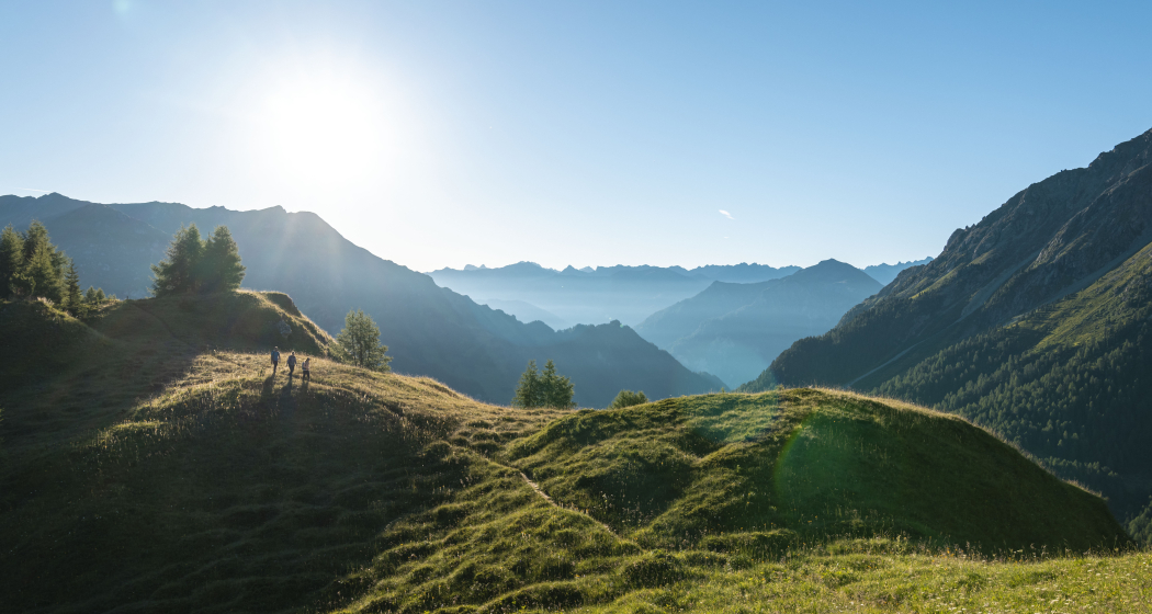
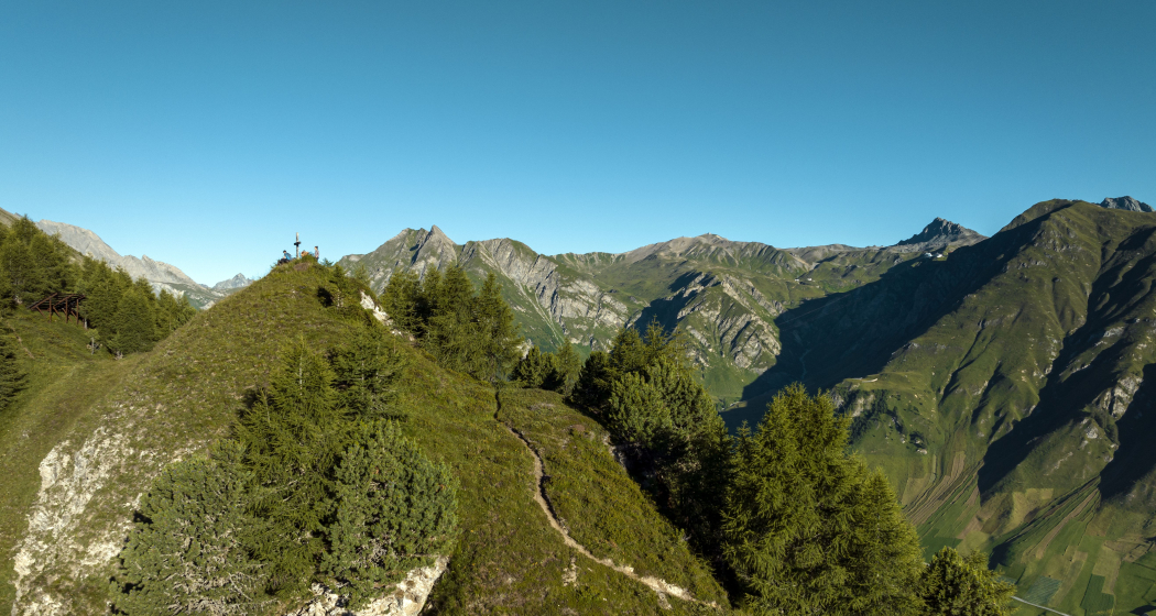
The route leads from Samnaun village on the slopes above the high valley from Samnaun to Compatsch, from where you can return by bus. You hike to and above the tree line. The steep flanks of the Piz Motnair with their debris streams and watercourses are crossed. You have magnificent views of the valley, the villages and views of the mountains beyond the valley. The safety measures in some places make this tour easily accessible for sure-footed and vertigo-free mountain hikers and bring a great hiking experience far above the settlement.
Ausrüstung
Normal hiking equipment and provisions appropriate to the weather.
Wegbeschreibung
From the signpost at the parking lot Votlas after signs Motta Saltuorn and Fuorcla Curschiglias (S) on a road upwards, past the boards of a fairy tale path on which the story of two marmots is presented very appealingly. You cross a stream descending from the Val Motnaida, pass a slate outcrop, alpine roses and arnica sites. Beyond the valley you can see the Trider Sattel, the Piz Ott and the Piz Munschuns. Then you reach the fork in the road Motta Saltourn (1), where you could already descend to Ravaisch, Plan and Laret. Continue upwards and after a bend to a hut with seating area and fountain. Then you reach the end of the road, turn left and climb steeper on a path. At the tree line you reach a bench and have a particularly beautiful view of Samnaun, into the Zeblastal to Piz Ott and pass the mighty Val Motnaida. Then you reach avalanche barriers and cross the Val Chiens below the Piz Motnair. Opposite the valley there is a panorama with numerous peaks. This is followed by the MottaFoppazins, a fork in the road (2), from which you could already descend and continue the route on a path running deeper on the slope. Continue on the upper path past a small peak with a cross, which is located exactly south of Compatsch and is therefore also referred to as Mittagsspitze. After a second cross, where you have a magnificent view again, you reach the Fuorcla Curschiglias (3). At this fork in the road, turn left after signs for Laret and Motta Foppazins. The direct descent to Compatsch is very steep and not recommended. Shortly afterwards follows another fork in the road where you continue in the direction of Compatsch Laret. At a bend with a fork in the road, continue in the direction of Compatsch Laret. After a junction to the valley path to Samnaun you come to the fork in the road Lartet Compatsch. On the right you reach the valley road at the junction Compatsch with bus stop (4).
Anfahrt
Öffentliche Verkehrsmittel
From the Lower Engadine with bus line 90.921 to Samnaun Dorf, Post
Arrival information
From the Lower Engadine on the roads No. 27 and 184 via Vinadi or over Kajetansbrücke, from Austria and from Italy Str. No. 180 to Kajetansbrücke, continue on Stichstr. to the center of Samnaun Dorf. Turn left on Votlastraße to the Votlas car park above the town centre.
Verantwortlich für diesen Inhalt Wandermagazin.
Dieser Inhalt wurde automatisiert übersetzt.
Diese Webseite nutzt Technologie und Inhalte der Outdooractive Plattform.